Compasses fail near the magnetic poles. Earth's magnetic field lines run almost straight down there, so the needle dips toward the ground or spins instead of pointing horizontally. GPS still works at both poles and can give you accurate latitude and longitude, but without a working compass it cannot tell you which way to walk in human terms.
Life has become fairly easy thanks to the invention of the Global Positioning System (GPS), the modern form of navigation. All you need to do is feed the location into the system and GPS will guide you. You basically can’t be lost!
However, the world wasn’t always this simple. GPS is a fairly new technology, so before it existed, the compass was the trusted and true adviser. Compasses have been used since 1 A.D. when they were first constructed by the Han dynasty. In fact, compasses and maps were once smuggled through Monopoly board games to prisoners of war stuck in Germany during World War II.
However, GPS and compasses, like any other technology, are not fail-proof, but instead work differently on different parts of the Earth.
In some places, they might even stop working entirely or work inaccurately!
The Mystery Of Earth’s Poles
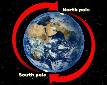
The Earth has two kinds of poles: Geographic and Magnetic. The Geographic poles are the northernmost and southernmost points of the planet, where the axis of rotation meets the surface. Every planet has geographic poles, and they don’t budge.
The Magnetic poles are different. They are the spots where Earth’s magnetic field lines plunge straight down into the ground (or shoot straight up out of it). Because the field is generated by churning liquid iron in Earth’s outer core, the magnetic poles wander, and not in a predictable, well-mannered way. The Magnetic North Pole has drifted out of the Canadian Arctic, raced across the Arctic Ocean at over 50 km per year during the 2000s and 2010s, and is now sitting closer to Siberia. The Magnetic South Pole, meanwhile, is slowly creeping away from Antarctica.
So when you ask a compass to point "north," it points toward Magnetic North, not Geographic North. The angle between the two is called magnetic declination, and it changes depending on where you are on Earth (and when). Maps used for navigation include a declination correction so that you can convert a compass bearing into a true bearing.
How Does A Compass Work?
A magnetic compass is one of the simplest pieces of navigation tech ever built: a lightweight magnetised needle balanced on a pivot, free to rotate horizontally. Because the needle is itself a tiny magnet, it aligns with Earth’s magnetic field, and one end is painted to mark "north."
That works beautifully across most of the planet, where the magnetic field lines are reasonably close to horizontal. But the field is three-dimensional. Near the magnetic equator, the field is almost flat, parallel to the ground. As you move toward the magnetic poles, it tips up (or down), until directly above the magnetic pole the field lines are essentially vertical.
That’s a problem for a horizontal compass needle. Near the poles, the horizontal component of the field, which is what swings the needle, shrinks to nearly nothing. The vertical component yanks the needle’s tip downward, so the needle wants to dip toward the ground rather than point in a useful direction. A standard handheld compass becomes sluggish, then erratic, then useless. Polar explorers and aircraft use specialised instruments such as the dip needle, gyrocompasses, or astronomical sights for direction-finding instead.
How Does GPS Work?
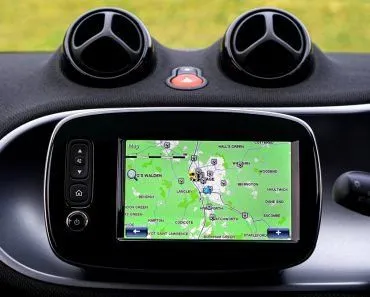
GPS, the Global Positioning System, works on a completely different principle from a compass. It does not care about Earth’s magnetic field at all. A constellation of around 31 active GPS satellites (operated by the US Space Force) orbits about 20,200 km above Earth, each broadcasting a precisely time-stamped signal. Your phone or GPS receiver listens to at least four of those signals and uses the tiny differences in arrival time to triangulate its position in three dimensions. Several other navigation constellations (Europe’s Galileo, Russia’s GLONASS, China’s BeiDou) work the same way.
Crucially, GPS satellites orbit at an inclination of about 55° to the equator. They pass over the polar regions often enough that you can still get a usable fix at the North Pole or the South Pole, though the geometry isn’t as good as at mid-latitudes. So yes, GPS works at the poles. What it gives you is a precise position: latitude, longitude, and altitude.
But position alone doesn’t tell you which way to walk. To turn a GPS fix into "head this way to your destination," your device also needs a heading, which in most consumer GPS units comes from… a compass. (Modern smartphones use a tiny electronic magnetometer instead of a swinging needle, but it still measures the same magnetic field.) When the magnetic field is too vertical to give a clean horizontal reading, the GPS still knows where you are, but it cannot reliably tell you the direction in which to start moving.
Navigation Vs. Magnetic Poles
To translate raw satellite data into "north" on your screen, GPS and aviation systems rely on the World Magnetic Model (WMM), a mathematical model of Earth’s magnetic field jointly produced by NOAA and the British Geological Survey.
The continuously shifting magnetic field warrants a new WMM every five years. You can compare it to a normal geographical map: if the landmasses kept shifting, you would need a new map every time to determine correct locations. Similarly, if the WMM your device is using is obsolete, a GPS app might lead you in the wrong direction.
The pole has been moving so quickly that the model has had to be updated ahead of schedule. NOAA released an out-of-cycle update in February 2019, followed by WMM2020 in late 2019, and the current WMM2025, released on 17 December 2024, will run through 2029. The 2025 version specifically tracks the rapid drift of the Magnetic North Pole toward Siberia and is used in everything from smartphone map apps to airline navigation systems and military hardware.
Do Compasses Work In The Southern Hemisphere And Antarctica?
A common worry is that a compass somehow flips or quits the moment you cross the equator into the Southern Hemisphere. It doesn't. The needle still lines up with Earth's magnetic field and still points toward Magnetic North, whether you are standing in Norway or New Zealand. What changes is the tilt of the field, not the direction the needle chooses.

Recall that Earth's field is three-dimensional. In the Northern Hemisphere the field lines angle down into the ground, so the north end of the needle dips downward. In the Southern Hemisphere the geometry is mirrored: the lines come back up out of the ground, and the north end of the needle wants to tip upward instead. This angle is called magnetic inclination (or dip), and it swings from steeply positive near the north to steeply negative near the south, passing through zero at the magnetic equator.
That vertical tug is why a cheap compass bought in Europe or North America can misbehave "down under." Its needle is weighted, or balanced, for the field tilt of one region. Carry it far into the opposite hemisphere and the needle drags against the top or bottom of its housing and sticks. Compass makers such as Suunto get around this by balancing needles for one of five zones (zone 1 covers most of the Northern Hemisphere; zone 5 covers Australia and the southern oceans), or by building a global needle whose magnet is free to tilt independently of the card, so the card stays level anywhere on Earth.
Antarctica is the extreme case. The South Magnetic Pole, where the field points almost straight up out of the ground, is not actually on the continent anymore. It drifted offshore and sat at roughly 64°S, 136°E in the Southern Ocean as of 2020, about 2,860 km from the geographic South Pole and creeping northwest by 10 to 15 km a year. So across most of Antarctica an ordinary compass does still swing, but the angle between where it points and true south (the declination) is enormous, and near the magnetic pole itself the needle goes vertical and useless, exactly as it does in the far north.
Does A Compass Work In Space?
Carry a compass up to the International Space Station and it would still work. At an orbital altitude of around 400 km, the ISS sits deep inside Earth's magnetosphere, the vast bubble of space that our magnetic field carves out, and the field up there is nearly as strong as it is on the ground. The needle would still swing toward Magnetic North. It would not make a precise navigation tool, though: geomagnetic storms driven by the Sun can shift a compass bearing by 10 degrees or more over a few hours, and that disturbance reaches into orbit too.

Travel farther and the field simply runs out. The Moon is the clearest example. It once ran a global magnetic field billions of years ago, but that internal dynamo died long ago (NASA dates the field's disappearance to roughly 1.5 billion years back), so the Moon has no planet-wide field today. All that survives are scattered patches of weakly magnetised crust, far too faint to steer a needle. An explorer with a pocket compass would get no useful "north" anywhere on the lunar surface.
Out in deep space the situation is starker still. Between the planets, the Sun's magnetic field is thousands of times weaker than the field at Earth's surface, and out among the stars the galaxy's own field is fainter yet. A traditional compass needle simply cannot feel a pull that small. That is why deep-space missions cannot navigate by magnetism; they steer using star trackers, Sun sensors, gyroscopes, and radio signals from Earth instead. A compass, it turns out, is a distinctly planet-bound instrument, and even then a reliable one only where the field lies reasonably flat.
Conclusion
A compass may sound like an outdated device, but your modern GPS leans heavily on one. The satellite signals tell your phone where it is; the compass (or a smartphone’s electronic magnetometer) tells it which way it is facing. Together, and with the help of the World Magnetic Model, they translate raw data into the arrow that points you toward your destination.
Travel to either of the planet’s magnetic poles, though, and that arrow stops being reliable. GPS will still happily track your latitude and longitude, but with the magnetic field lines pointing nearly straight down, the compass component fails, and "head north" becomes a question that no longer has a useful answer.
References (click to expand)
- Smith College Museum of Ancient Inventions: Compass. Smith College
- Monopoly, Maps, and the Great Escape | UC Geography - geog.ucsb.edu
- Compass. University of Alicante
- Earle, S. Physical Geology, 9.3 Earth's Magnetic Field. BCcampus OpenEd.
- World Magnetic Model. NOAA National Centers for Environmental Information.
- The 2025 World Magnetic Model is Now Available. NOAA NCEI (Dec 17, 2024).
- GPS Space Segment. gps.gov (US Space Force).
- How Does GPS Work? | NASA Space Place. The National Aeronautics and Space Administration
- World Magnetic Model - Uses - NOAA. The United States National Geophysical Data Center
- Understanding balancing zones. Suunto.
- Magnetic dip. Wikipedia.
- South Magnetic Pole. Wikipedia.
- Earth and Moon Once Shared a Magnetic Shield. NASA.
- A Compass Works Differently in Space. Discover Magazine.