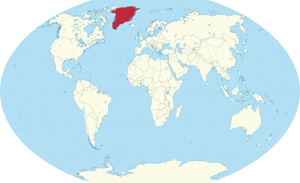
Greenland sits at the crossroads of the Arctic between North America and Europe, making it strategically vital for three reasons: its commanding position for missile-warning and Arctic surveillance (the U.S. operates Pituffik Space Base, its northernmost military installation, there), vast untapped reserves of rare earth minerals and oil beneath its ice sheet, and new shipping lanes — including the Northwest Passage — opening up as the ice melts. Greenland is the world's largest island, though the Mercator projection makes it look even bigger than it really is.
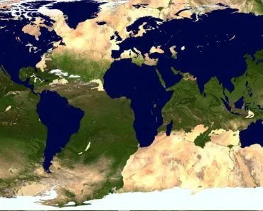
Have you ever seen Greenland on a world map? It appears to be enormous, right? However, it is just the Mercator projection’s trick that causes it to appear stretched out and significantly larger than it is in reality. That being said, Greenland, the icy landmass floating between the Arctic and Atlantic Oceans, is actually quite large, but not as large as it appears on maps. Despite being the world's largest island, Greenland has a population of only about 56,000 people — making it one of the least densely populated territories on Earth.
Greenland’s geography is fascinating and unusual, but did you know that Greenland’s distinctive terrain makes it strategically crucial for nations around the world? Let’s break down the reasons that make this icy island so important.
Where Is Greenland?
Greenland sits at the top of the world, tucked between the Arctic Ocean to the north and the North Atlantic to the south. Despite its frosty Arctic identity, it is structurally part of North America: geologists describe it as an extension of the Canadian Shield, the same ancient bedrock that underlies much of Canada. Politically, however, Greenland is an autonomous territory within the Kingdom of Denmark, which is why most maps colour it in the same tone as a European country.

Its closest neighbour is Canada. At its narrowest, the Nares Strait separates Greenland from Ellesmere Island by just 26 km (16 mi), close enough that, on a clear day, you can see one country from the other. To the southeast, Iceland lies roughly 320 km (200 mi) away across the Denmark Strait. Look further and you find the United Kingdom and continental Europe across the open Atlantic, and the United States across the Labrador Sea and Canada.
Greenland is officially the largest island in the world, sprawling across about 2.16 million km² (836,000 sq mi). And yet, despite that vast footprint, only around 56,500 people live there, mostly in small settlements scattered along the ice-free coastal fringe. The capital, Nuuk (formerly Godthåb), sits on the southwestern coast and is home to roughly a third of the country's population. Greenland was granted home rule by Denmark in 1979, and after a 2008 referendum, it took on expanded self-government on 21 June 2009, including authority over its own natural resources.
How Big Is Greenland, And Why Does It Look Even Bigger On Maps?
Open any classroom world map and Greenland looks enormous, often appearing roughly the same size as the entire continent of Africa. It is not. Africa covers about 30.4 million km² (11.7 million sq mi), while Greenland covers about 2.16 million km² (836,000 sq mi). Africa is roughly 14 times larger than Greenland, not similar in size.
So where does the optical illusion come from? Blame the Mercator projection, the cylindrical map projection devised by Flemish cartographer Gerardus Mercator in 1569. It was designed for sailors, because it preserves angles and compass directions, making navigation across oceans straightforward. The trade-off is that it badly distorts area as you move away from the equator. Mathematically, the linear scale grows as the secant of latitude (1/cos φ), so the area scale grows as sec²(φ). At 60° latitude, landmasses are stretched fourfold in area. At Greenland's mid-latitude of roughly 73° north, the area scale factor is about 11.7. In simple terms, Greenland on a Mercator map looks almost twelve times bigger than it really is.
To get a feel for Greenland's true size, it helps to compare it with familiar landmasses: it is about three times the size of Texas, nearly nine times the United Kingdom, and a touch under 30% of Australia. Still huge, but not continental.
This matters for more than trivia. The same projection quirk that inflates Greenland also visually shrinks countries near the equator, subtly skewing how generations of readers have pictured the world. It is one of the reasons cartographers now favour equal-area projections, like the Robinson or Gall-Peters, for thematic world maps.
Why Is It Called Greenland If It's Mostly Ice?
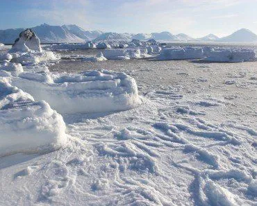
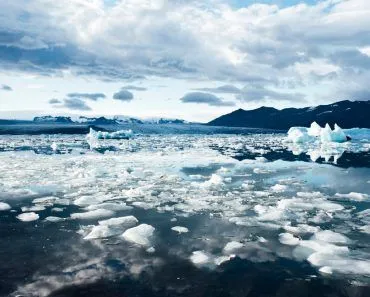
It is a fair question. About 80% of Greenland is buried under the Greenland Ice Sheet, a frozen slab averaging more than 1.5 km thick and covering roughly 1.7 million km² (656,000 sq mi). Step off the narrow coastal strip, and the country is overwhelmingly white, not green. So why "Greenland"?
The name comes from a Norse outlaw named Erik the Red. Around 982 CE, Erik was banished from Iceland for three years after a series of feuds, and he used the time to sail west and explore the unknown landmass on the horizon. When he returned to Iceland in 985 or 986, he set about recruiting settlers for a new colony, and he gave the place a deliberately appealing name. According to early Icelandic sagas, Erik believed that "a good name would attract settlers." It worked: he sailed out with 25 ships, 14 of which successfully made the crossing, founding the Norse settlements that would survive for nearly 500 years.
The pitch was not pure invention either. Erik landed during the Medieval Warm Period, when southern Greenland's coastal fjords really were green enough during summer to graze sheep and grow modest crops. The Norse colonies eventually faded around the 15th century as the climate cooled into the Little Ice Age, but Erik's branding stuck. Today, the island's name is a memento of a warmer, greener moment in its history, and arguably the first recorded case of clever real-estate marketing.
The Position Of Greenland And Geopolitics
Greenland is situated at the heart of the Arctic region on almost every map. Imagine Greenland as a central hub, akin to a watchtower, holding a strategic position between two significant continents, North America and Europe.
This geographical location provides a unique vantage point for watching both internal and external actions within the Arctic’s frozen borders. It enables Greenland to monitor operations in the Arctic region as a whole. Satellites may provide remote observational data, but the unique position of Greenland gives better insight to the Arctic circle.
As a result, Greenland’s location has far-reaching implications for global politics, military strategy, and economic interests.
Furthermore, the island’s strategic significance extends beyond trade and economy. Because of its geographical location, governments can monitor the activities of neighboring countries and international entities in the region. This monitoring capability is critical for understanding military asset mobility, natural resource development, and scientific research. As a result, states with Arctic interests work hard to establish partnerships and diplomatic relations with Greenland in order to gain a foothold in the region, thus allowing them to safeguard their strategic interests.
The strategic interest in Greenland became dramatically visible in 2025, when U.S. President Donald Trump revived and escalated his pursuit to acquire the island, threatening tariffs on Denmark and appointing a special envoy to Greenland. Vice President JD Vance visited the U.S. military's Pituffik Space Base in Greenland in March 2025. Both Denmark and Greenland repeatedly stated the island is "not for sale," with Greenland's prime minister declaring that Greenlanders would choose their own future. In early 2026, Trump announced a "framework" deal with NATO, though details remained unclear. The episode underscored just how strategically valuable Greenland has become on the world stage.
The United States already operates Pituffik Space Base (formerly Thule Air Base) in northern Greenland — the northernmost U.S. military installation in the world. Located 1,210 km north of the Arctic Circle, it conducts critical missile warning, missile defense, and space surveillance missions. In 2025, the Pentagon announced plans to invest $25 million in upgrading the base's infrastructure, signaling continued strategic interest.
Greenland also serves as a major crossroads for nautical operations and commercial routes, as it is a gateway between the vast Atlantic and Arctic Oceans. Consider it as a bustling marketplace where ships from all over the world exchange a diverse assortment of products and commodities.
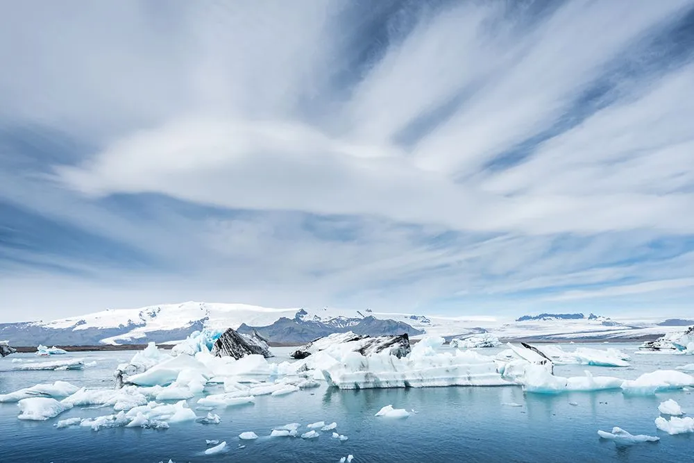
Greenland’s Melting Ice Is Opening Up New Possibilities
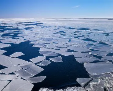
As global temperatures rise, Greenland’s ice is melting at an alarming rate. This melting ice serves as a stark reminder of how serious climate change truly is. According to NASA satellite data, the Greenland Ice Sheet has been losing an average of approximately 264 billion metric tons of ice per year since 2002, significantly contributing to rising sea levels and impacting weather patterns around the world. The ice sheet has experienced net mass loss for 29 consecutive years as of 2025.
However, this melting ice also opens up new commercial avenues and resource exploitation potential.
As Arctic ice melts, previously (almost) impassable routes become more accessible. Commercial shipping companies see this as a chance to build shorter shipping routes between Europe, Asia, and North America. The once-impassable Northwest Passage, for example, is progressively opening up, providing a tempting shortcut for marine traffic.
Also, beneath the icy surface of Greenland sits a treasure trove of precious resources. Greenland ranks eighth in the world for rare earth reserves, with 1.5 million tons, and is home to the Tanbreez deposit — potentially the world's largest rare earth deposit at 28.2 million metric tons. Oil, gas, and critical minerals utilized in modern technologies and AI infrastructure are lying dormant there. In 2025, the U.S. Export-Import Bank offered $120 million to fund the Tanbreez rare earth mine, while the EU designated Greenland's Amitsoq graphite project as a Strategic Project under its Critical Raw Materials Act. However, no rare earth projects have entered commercial production yet, as infrastructure gaps and extreme conditions dramatically extend development timelines. The melting ice makes it easier to access these precious resources, and governments seeking economic growth and energy security are eager to capitalize on this opportunity. The competition for Greenland's resources has become a three-way race between the United States, the European Union, and China — all seeking to diversify their critical mineral supply chains, as China currently dominates global rare earth production. Greenland previously cancelled a Chinese-backed uranium and rare earth mine at Kvanefjeld due to environmental and public health concerns.
Scientific Exploration
Greenland’s geography offers an intriguing landscape for scientific investigation. Almost 80% of the island is covered by a huge ice sheet, which serves as a massive record keeper of Earth’s former climates. Scientists travel to Greenland to examine the huge glaciers, which act as frozen time capsules containing vital data on past environmental alterations.
To learn about the past, experts, particularly geologists, carefully retrieve ice cores from glaciers. These ice cores include vital information regarding temperature swings, previous volcanic eruptions, and greenhouse gas levels dating back thousands of years. Scientists obtain important insights into our planet’s historical temperature shifts by researching these ice cores, revealing information on the delicate balance between Earth’s climate systems.
Greenland’s frozen terrain is a rich trove of data in our perennial quest to understand Earth’s climate history. Each ice core segment, like peeking into the layers of an ancient book, offers a glimpse into the past, narrating stories of atmospheric conditions, natural disasters, and long-lost climatic events.
The data recovered from Greenland’s glaciers allows scientists to better understand the complexities of our planet’s historical climatic shifts, allowing them to better project and plan for the future. As humanity grapples with the issues of climate change, the importance of scientific study in Greenland cannot be overstated.
Conclusion
The unique geography of Greenland is of crucial strategic importance to nations across the world. It is a sought-after area for economic, geopolitical, and security purposes due to its vast landmass, abundant natural resources, and strategic location in the Arctic region. As climate change continues to impact the Arctic, melting ice opens up new opportunities for resource extraction, transit routes, and scientific research, further adding to Greenland’s allure.
As a result, governments around the world are closely monitoring and engaging with Greenland in order to secure access to its resources and ensure regional stability. Understanding and navigating Greenland’s strategic relevance will be important in shaping global connections and collaboration in the 21st century.
Greenland is currently a self-governing territory within the Kingdom of Denmark. A strong independence movement is gaining momentum — a 2025 poll showed 84% of Greenlanders support independence, though a majority opposed it if it meant a lower standard of living. A commission is expected to present conclusions on the path to independence in late 2026. This evolving political status adds another layer of complexity to the geopolitical competition over the island.
References (click to expand)
- Hall D. R. (2021). Tourism, Climate Change and the Geopolitics of Arctic Development: The Critical Case of Greenland. CABI
- Goode, J. P. (1925, September). The Homolosine Projection: A New Device For Portraying The Earth'S Surface Entire. Annals of the Association of American Geographers. Informa UK Limited.
- Masson-Delmotte, V., Swingedouw, D., Landais, A., Seidenkrantz, M.-S., Gauthier, E., Bichet, V., … Vinther, B. (2012, August 10). Greenland climate change: from the past to the future. Wiley Interdisciplinary Reviews: Climate Change. Wiley.
- Dodds, K. & Nuttall, M. Materialising Greenland within a Critical Arctic Geopolitics. Routledge.
- Glikson, A. Y. (2019, May 31). North Atlantic and sub-Antarctic Ocean temperatures: possible onset of a transient stadial cooling stage. Climatic Change. Springer Science and Business Media LLC.
- Why Is Trump So Intent on Acquiring Greenland? Time.
- What to know about Pituffik, the only U.S. military base in Greenland. NPR.
- Greenland elections are dominated by independence and Trump's interest in the island. NPR.
- Greenland Ice Mass Loss 2002-2025. NASA Scientific Visualization Studio.
- Greenland, Rare Earths, and Arctic Security. CSIS.
- The race for Greenland's rare earth minerals is heating up. Chatham House.
- Greenland. Encyclopædia Britannica.
- Erik the Red. Encyclopædia Britannica.
- Ice Sheet Quick Facts. National Snow and Ice Data Center (NSIDC).